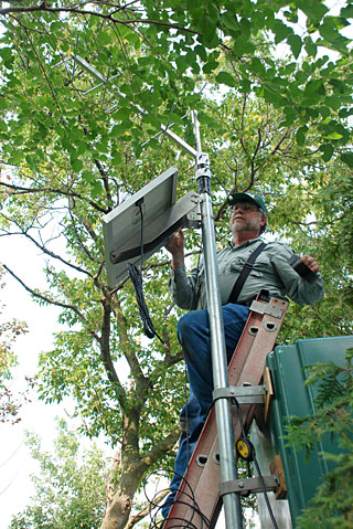
Alan Dillenburg, a hydrologic technician with the U.S. Geological Survey Ohio Water Science Center in Columbus, installed a solar panel to power a stream-gauging station for the Ottawa River on Main Campus.
“In order to properly manage our water resources, we must have the means to measure them,” said Dr. Hans Gottgens, professor of environmental sciences.
On Aug. 13, the United States Geological Survey completed the installation of a new satellite-driven stream-gauging station on Main Campus for the Ottawa.
“Our campus is now part of a national network for obtaining instantaneous water resource data,” Gottgens said.
Using satellite telemetry, real-time data on water level and flow are recorded every 30 minutes of every day and transmitted over a 22,000-mile, high-altitude satellite to the U.S. Geological Survey National Water Information System for processing and public access through the Web here.
The entire station is operated by a 20-watt solar power panel and was funded through the American Recovery and Reinvestment Act.
Gottgens said the original station has recorded water levels and discharge on campus since the 1940s, but data were only available as annual summaries.
The request to upgrade the station to satellite telemetry came from the President’s Commission on the River, a group dedicated to improving the Ottawa River on campus for research, teaching and public outreach. The commission has been the driving force behind the rain gardens, the new student plaza behind the Student Union and Carlson Library, stream restoration projects, native plantings, the Rocket Terrace near Savage Arena, and the Clean Your Streams program on campus.
“The U.S. Geological Survey responded very quickly to our request, and this is a real improvement in our ability to monitor the Ottawa River on campus,” said Gottgens, who is a member of the river commission. “Water resource data from the station will benefit student research projects on the river and will be used in classes in environmental sciences, geography, ecology, hydrology and engineering.”