
Geographers have long been asking questions about the complex relationships between humans and their world: Why do asthma rates worsen in one region while they improve in another? Why do harmful algal blooms develop in western, but not eastern, Lake Erie? Where should cities invest in roads so they and their neighbors can reach jobs?
Answers to these and other questions are closer than ever as the datasets geographers consider grow in volume and complexity while the tools they use to make sense of them grow increasingly powerful.
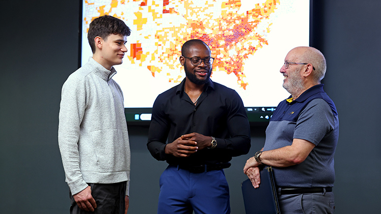
From right, Dr. Patrick Lawrence, a professor and chair of the Judith Herb College of Arts, Social Sciences and Education’s Department of Geography and Planning, speaks with Ph.D. candidate Oluwaseun Ibukun and undergraduate Jack Cowell. UToledo recently launched just its undergraduate Geospatial Science Program.
“We’re talking about spatial computer-based models that might have taken us months to design and then weeks to run,” said The University of Toledo’s Dr. Patrick Lawrence, a professor and chair of the Judith Herb College of Arts, Social Sciences and Education’s Department of Geography and Planning. “Now we can condense the whole process into hours or days.”
Students are at the cutting edge of these processes at UToledo, which hosts undergraduate and graduate geography degree programs that prepare students for the data-driven careers that are growing in demand according to the U.S. Bureau of Labor Statistics.
These include a just-launched undergraduate Geospatial Science Program, which stands out as the first in the region to teach students how to analyze information tied to place, from the GPS data generated by delivery and workout apps to the location coding in photos, online mapping and other sources. The new program builds on the strengths of established bachelor’s and master’s geography programs at UToledo, as well as a competitive doctoral Spatially Integrated Social Sciences Program, which remains one of the only programs of its kind to apply geospatial technologies to the study of human and social dynamics.
Geography students in each program master tools of their trade including digital cartography, remote sensing and geographic information systems, which are in turn being transformed by artificial intelligence and other advanced technologies.
“Our students are empowered to really push the envelope of the concepts and the technology,” Lawrence said. “With access to expert faculty who publish and present their work nationally, the rapidly developing technology that’s in use across the industry, and opportunities to apply what they learn at many of the organizations responsible for shaping our own community, they’re starting careers ready to drive their industries forward.”
Geospatial Science
The Geospatial Science Program is significant as the first of its kind in Northwest Ohio, with a curriculum that pushes undergraduate students beyond traditional geography and geographic information science.
The new program prepares students to collect, analyze and visualize patterns in locational data, ultimately turning raw data into actionable insights for industries including logistics, market research and supply chain management as well as government agencies including the U.S. Census Bureau and Internal Revenue Service.
Graduates will meet a growing need in the job market, with national and state agencies tracking placement rates for related occupations as higher than the national average.
Students will begin working toward those careers before they graduate, in line with a new initiative championing experience-based learning opportunities across the University and a long-standing tradition in the Department of Geography and Planning. Its faculty and students enjoy a close relationship with alumni-driven organizations like the Lake Erie West Regional Council, encompassing area counties, cities, villages and townships.
Undergraduate Jack Cowell took notice of graduates landing jobs at the Lucas County Auditor’s Office and the city of Toledo as he settled into the Geography and Planning Program. He liked the combination of a curriculum heavy on applied geography with the opportunity to make a smart investment in his education.
He’s interested in perhaps joining his department’s alumni at the city of Toledo.
“UToledo is helping to prepare me to achieve this goal,” he said.
Spatially Integrated Social Sciences
UToledo is uniquely positioned to support the new Geospatial Science Program, with an established infrastructure of expert faculty specializing in areas ranging from agricultural practices, housing trends and the craft brewing industry, plus state-of-the-art software and equipment in the Center for Geographic Information Sciences and Applied Geographics.
These resources support undergraduate and graduate geography programs, including the nationally known doctoral Spatially Integrated Social Sciences Program.
This program’s students stand out for their interdisciplinary approach to research, which applies geospatial technologies and related tools to advance how we understand nearly every domain of the social and behavioral sciences. Their work contributes to an extensive research ecosystem across the University — the only R1 institution in Northwest Ohio.
Among these researchers is Ph.D. candidate Oluwaseun Ibukun, who brought an undergraduate degree in agricultural economics and a graduate degree in financial economics to the Spatially Integrated Social Sciences Program. Here he nurtured an interest in the spatial prevalence of health-related phenomena that’s led to eight academic publications ahead of the dissertation he expects to defend prior to his anticipated graduation in December.
This dissertation explores the spatial prevalence of adult asthma in the United States between 2018 and 2021, while also predicting trends in the respiratory disease from 2022 to 2025. He is investigating the demographic, environmental, socioeconomic and health- and transportation-related factors influencing adult asthma in the 3,109 counties that make up the contiguous United States. In analyzing factors that led adult asthma rates to increase or decrease over the four years, he is pinpointing considerations that could help individuals or communities.
“Asthma doesn’t have a single cause, but my research shows that two major factors, poverty and particulate matter (PM 2.5), were significantly influencing the spatial prevalence of adult asthma across all the years,” Ibukun said. “Because we can see exactly where adult asthma rates have improved or worsened over time, we can also see how those factors inform those trends, and how targeted interventions could be enacted accordingly.”
His work reflects one way that UToledo’s Department of Geography and Planning, building on its established strengths, is preparing students to turn data into decisions in Northwest Ohio and across the United States.
